Recent advances in 360 cameras and 3D photogrammetry software have opened up new possibilities for underwater science, exploration, and virtual reality.
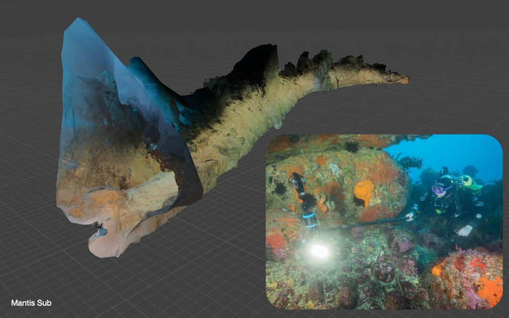
Mantis Sub, a leader in underwater 360 technology is excited to share their recent success constructing a 3D photogrammetry model of an underwater cave in less than an hour, based on a short 360 video from a single dive.
Previously, creating a photogrammetry model of an underwater cave has been prohibitively time consuming and expensive. Such a model would require many hours of painstaking photography work, and specialised equipment such as DSLR and mirrorless cameras on a tripod.
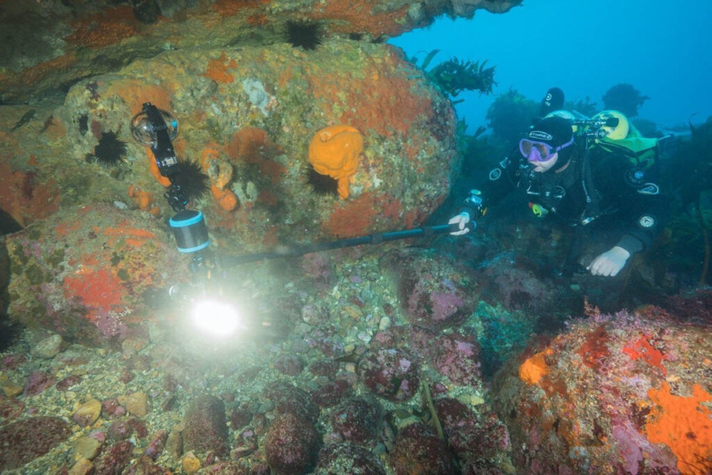
In comparison, we created a textured model in under an hour using the Insta360 ONE RS 1-inch 360 Edition camera, a Mantis RS360 housing, three Sola Video Pro 3800 video lights, and the Metashape Standard Edition software (total cost US$4,326).
A comprehensive description of how we created this model is outlined in this tutorial: Photogrammetry: How to create a 3D model from 360 video in an hour or less.
“This is a real break-through for 3D modelling of the underwater world. What previously required many hours or days and expensive equipment, can now be done in minutes with a simple camera set-up,” says Axel Busch, founder of Mantis Sub.
Advances in 360 camera and 3D modelling technology expand possibilities
Photogrammetry has traditionally involved taking hundreds or thousands of overlapping photos of an object, and converting them into a 3D model using computer algorithms that can detect and match features between images. The “point cloud” of these features represents the surface of the 3D model.
Current perceptions are that 360 video can’t be used for photogrammetry, because low resolution and ‘muddy’ image clarity do not allow the algorithms to correctly match features. However, simultaneous advances in camera sensor technology and video encoding, as well as in 3D modelling software have changed what is possible.
Modern 360 consumer cameras offering 1-inch sensors can now record high resolution images that work with 3D modelling algorithms. These algorithms are specifically designed to work efficiently with 360 images.
Where traditional methods require at least six images for each location (one per cardinal direction plus up and down), a 360 photo captures the whole environment in one photo. This dramatically reduces the number of photos the algorithm has to process and makes it possible to use standard consumer computers such as gaming laptops or Macbooks, instead of specialised workstations with expensive graphic cards. At the same time, this software has become affordable for consumers as well.
Just one pass with a 360 degree camera during a regular scuba dive can be enough to map an entire underground cave. While 360-derived models do have less detail than models derived from stills photographs, the benefits of using 360 video are ease, speed, and affordability.
Wide ranging applications
There are applications for this technology in a wide range of fields:
- for cartographers wanting to map overhead environments,
- architects wanting to create digital twins of existing structures,
- game developers wanting to save time designing natural environments,
- and historians wanting to digitally preserve structures of cultural significance, such as wrecks or buildings.
In the realm of science, such models can support scientific endeavors such as archaeology, hydrogeology, geology, mineralogy, and paleoclimate studies, just to name a few.
Enabling the exploration of previously unexplored environments
Traditionally, complex underwater caves have been surveyed using a continuous line with knots paired with compass measurements, resulting in simple 2D maps. In contrast, 3D models provide more experiential and manipulable maps. Models can easily be cut crossways, for example, to create a floor plan of a given area.
3D mapping of previously unexplored natural environments is now possible with a single mounted camera using remotely controlled (ROVs) or autonomous underwater vehicles (AUV’s). In situations where technical divers are still required to explore dangerous underwater environments, such as wrecks or underground cave systems, access to 3D models will greatly improve their planning and preparation, increasing diver safety in the face of significant physical and psychological barriers.
Bringing the underwater world into view
3D modelling makes it possible for non-divers to fully experience and explore underwater environments that have previously been hidden from view. Complete immersion made possible by 3D models increases a sense of presence, and allows for full visualisation of underground structures. Augmented reality (AR), virtual reality (VR), and mixed-reality technologies can then be used for purposes as diverse as education, exhibition, expedition planning, reconstruction, and virtual museums – changing how people engage with the fascinating beauty and detail of our underwater world.
In closing …
Recent advances in 360 camera and 3D modelling technology have made it possible to easily create quality photogrammetry models that were previously prohibitively expensive in both time and equipment.
With the Mantis RS360 underwater camera housing and Insta360 One RS 1-inch 360 Edition, we have a simple yet powerful set-up that can empower scientists, explorers, and creators, as well as raise awareness about our fascinating underwater world.
For further information about our housings, please visit https://www.mantis-sub.com/
Mantis Sub is dedicated to creating robust underwater housings that make professional 360 videography and photography more affordable and accessible


